|
South Point is the southernmost point in the United States located in the district of Ka'u between Kona and Volcano on the Big Island of Hawaii. South Point is one of the most remote and beautiful drives on the Big Island, an easy day trip from Kona. If you are driving to the East side of Hawaii to visit Hilo or Volcano, you may want to take time to drive to South Point.
Below is a photo tour of the drive on Highway 11, also called Hawaii Belt Road, from Kailua-Kona to South Point. The turn off to South Point Road is located between marker 69 and 70 on Highway 11. It starts as a two lane road and becomes a single lane road. The road forks into two road in the South Point area, the right road going to the Coast Guard light beacon and the left road going to an old military base and the trail head of green sands beach.
Kailua-Kona to Captain Cook
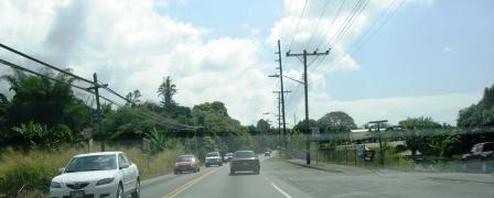
From Kailua-Kona, take Highway 11 south. The traffic in south Kona can be completely jammed up during rush hour, so it is best to plan your trip to miss rush hour. The 10 miles between Kailua and Captain Cook have many tiny towns, like Kainaliu, with shops, cafes, and theaters. .
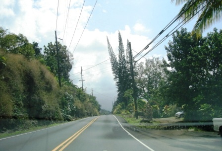
Highway 11 leaves the Kona district and enters Ka'u district (the district with South Point) just before Manuka State Park. Manuka is a great place to rest with bathrooms and a hiking trail.
Back to Top
Ocean View
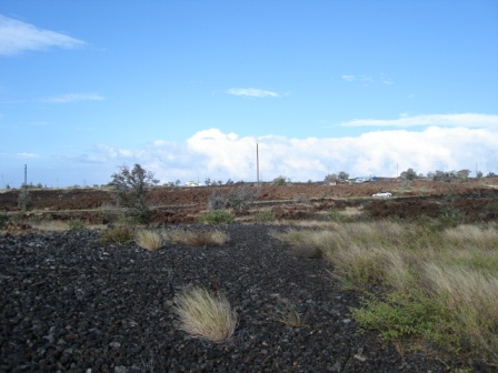
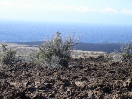
After Manuka State Park is a community called Ocean View where there are grocery stores, restaurants and stores. Ocean view is a growing residential area with numerous subdivisions including HOVE (Hawaiian Ocean View Estates, HOVR (Hawaiian Ocean View Ranchos), Kula Kai View Estates, Kona Gardens, Kona View Estates and others. HOVE has over 10,000 one acre lots on the mountain side (mauka) of Hwy 11. Many of the lots are lava, like the picture below. Elevation at the Hwy 11 is 1,500 feet and HOVE rises up Mauna Kea to over the 5,000 foot level.
Across Hwy 11 from HOVE, on the ocean side (makai), is Hawaiian Ocean View Ranchos (HOVR) which has over 1,200 three acre lots that are lower than the highway, many with unobstructed 180 degree views of the coast line and Southpoint.
Other ocean side subdivisions near HOVR, like Kula Kai, also have 3 acre view lots and several have controlled access to the lots to increase security.
Ocean View Town center, on the mountain side of Hwy 11, has the Kahuku Country market, natural foods deli, and an ACE hardware store. A new grocery store is located near Hwy 11. At the HOVR entrance (on the ocean side) is the Pohue Plaza which has a Malama Market grocery store, Kahala Gas station and mini mart, "The Wash" laundromat, and L&L cafe.
If you want to stay in the Ka'u area, there are Bed and Breakfast establishments. The grocery stores have all the fixings to make a picnic lunch for an adventure to a local beach.
Back to Top
South Point
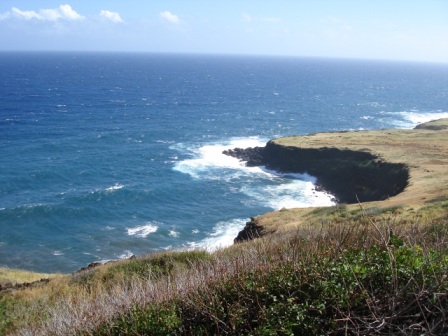
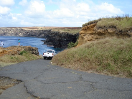
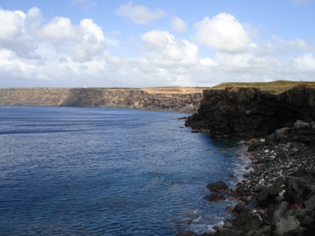
After driving out of Ocean View on Hwy 11, there is an overlook on the ocean side of the road with a view of South Point. Between Ocean View and Na'alehu, at mile marker 69-70, is South Point Road to go to the southernmost tip of the USA. The road starts out as a well paved narrow road and quickly turns into a one lane road. You have to pull over to the side to let other vehicles go by.
The fork in the road is 10 miles from Hwy 11. The road toward the right leads to a very rough parking lot next to the South Point cliffs.
At the end of the road, there is a huge drop off below. You can climb around on the cliff to get great views of the ocean, but huge crumbling lava tubes make it very dangerous to navigate
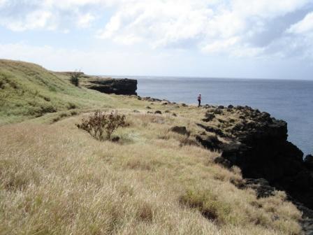
It is very dangerous to swim or snorkle in the bay below due to strong currents that pull you out to sea.
The actual South Point is in front of the Coast Guard light beacon. It is south of the parking lot where a rutted road leads.
Back to Top
Copyright 2009 - 2011
|